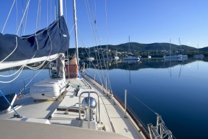
 The day our dear friends departed, they took ALL of the wind… Our next leg was about 450 nm from Culebra to Great Inagua – The Bahamas (!!!) so we were stuck until wind could fill our sails. Mike took another stab at aligning the prop shaft/V-drive using a new app called Vibration. Using an accelerometer, it charts 3 different frequency waves to measure the vibration of our engine alignment (thanks Nate for suggesting this!).
We kept a watchful eye on passageweather.com and saw a decent weather window that we decided to take. It would be light wind the first few days with building stronger winds the last few days – we were okay with that.
But before we really started the journey we topped off on diesel fuel and water in Fajardo, mainland PR. It was then I noticed our diesel prices throughout the trip.
2015 Oct – VA USA $2.03/g
2015 Dec Bermuda $4.50 /g (and that was greatly subsidized!)
2016 Mar St. Thomas USVI $3.14/g
2016 Apr Fajardo PR $2.45/g (we unfortunately did A LOT of motoring in Mar/Apr)
2016 May Georgetown Exuma $3.72/g
Priciest fuel goes to Bermuda, Cheapest goes to VA
Our passage from PR to Great Inagua Matthews Town took us 4 full days, we arrived in Matthews Town at midnight Friday. We did 4 hours on, 4 hours off for shifts but again, since it was a short(er) passage we were a bit lenient on the shifts. The first day was great sailing. Puerto Rico appeared more mountainous than I imagined and I hope to explore mainland PR one day. The second day, I was feeling a bit under the weather, and I don’t think it was seasickness, it felt different. 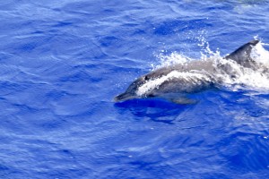 Mike was amazing and pulled off a 7 hour night shift for me and the next day I began to pull through my ‘funk’.
Also worth mentioning, we passed over/ by the Puerto Rico trench. The trench extends 500 miles long and it’s deepest point is Milwaukee Deep at 28,373 feet, the deepest point in the Atlantic Ocean.
It turned out to be gorgeous sunny sailing. A pod of 16-18 porpoises swam alongside Gaia, playing in the bow wake for a while and we both got a kick out of that. Later, while Mike was asleep, the USCG helicopter circled the boat twice before disappearing over the horizon. We suspected they were doing routine checks in the area for drug control. 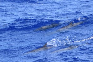 We passed the northern entrance of the Mona Passage effortlessly – the Mona Passage is notorious for being the biggest in-to-the-wind passage for sailors headed toward the Virgin Islands. Reason # 738 why I’m glad we went to Bermuda then down to Antigua to follow the trade winds back home – one less pain in the butt windward sail for us.
On day 3, the winds picked up to 20-25 knots and we dropped the main in some decently sized waves which made the entire process…. uhm….”sporty”. For my night watch, I pulled my foulies on in preparation for a few looming storm clouds. No moonlit night sailing this time, it was far more stressful for me this time. A cargo ship was approaching at 13 knots but I lost visual of it in a particularly thick squall that passed. I monitored the cargo ships progress via AIS (AIS is a way to track other boats progress through the water on your GPS, ours is receive-only). Once the squall passed I looked behind me where the GPS showed the cargo ship, only to find darkness. The cargo ship was much much closer than what our GPS was reading & on top of that the controls on our GPS were not functioning. I jibed to get further away from the path of the cargo ship. After the jibe, I took another look around and noticed a single tall white light. I starred at it for a few minutes trying to calculate just what the heck the light was. It couldn’t have been a rocky shallows off the coast the DR – maybe it was a buoy, or another sailboat without red/green running lights. Whatever it was, my current heading could be on close collision course with said mystery light. After a few minutes, I decided it’d be best to jibe and steer clear. I looked over my shoulder to see where that cargo ship was… but another squall had hit. The winds picked up, the rain was slamming down, and I had a mystery light ahead of me and a cargo ship hiding in the squall on my starboard – all with a GPS that was none-too reliable. Earlier, I had looked up the cargo ships AIS data and found the name of the ship so I went down below and hailed the cargo ship on channel 16. “Cargo ship XYZ, cargo ship XYZ, this is the sailing vessel on your port bow” A pregnant pause and then there was a response!!! A complete and utter stranger responded back to me at 2:00 AM in the middle of a squall! I don’t know why I wasn’t expecting a response but my heart was pounding, I was so excited. Since 16 is purely a hailing and distress channel, I was very curt and requested their course over ground / heading. He responded and I said thanks. I looked at the compass and estimated my new course through the water once I jibed & saw I’d be in the clear, close to the cargo ship but in the clear. I made my jibe and about 10 minutes later the squall passed and I saw on my port bow the cargo ship putting along at it’s 13 knots.
The rest of the sail was a breeze and rather dull. We dropped anchor at 11:50 PM on Friday night and we both slept soundly on Gaia in the Bahamas. We were finally here. Only west and north from here until Boston.
WOW, your story about the cargo ship, squall and mystery white light was amazing. so proud of how you handled things.
WAN